How to fold a Layout in ArcGIS Pro
Date
February 16, 2021
Views
2,667 Views
Reading Time
7 Mins Read
How I combine Gradients as Symbol Layers in ArcGIS Pro to apply a folding effect to the Layout.
How to fold a Map with CSS
Date
February 2, 2021
Views
3,500 Views
Reading Time
9 Mins Read
How I leverage CSS to simulate the folds for any map uploaded as an img element.
Anaglyph 3D with blend modes in ArcGIS Pro
Date
January 25, 2021
Views
6,830 Views
Reading Time
9 Mins Read
How I manually produce an Anaglyph 3D image for any place in the World with blend modes in ArcGIS Pro.
Shadowplay in Bryce Canyon
Date
January 10, 2021
Views
3,119 Views
Reading Time
6 Mins Read
How I produce a custom multi-directional shaded relief of the Bryce Canyon with manually combining different illumination sources in ArcGIS Pro.
eARTh Engine: Turn cold pixels to a colorful Terrain
Date
January 6, 2021
Views
6,578 Views
Reading Time
10 Mins Read
How I produce a hypsometric tinted multi-directional shaded relief of the entire World in Google Earth Engine.
Kilauea Volcano: Shaded Relief or Edge Detection?
Date
December 28, 2020
Views
2,951 Views
Reading Time
9 Mins Read
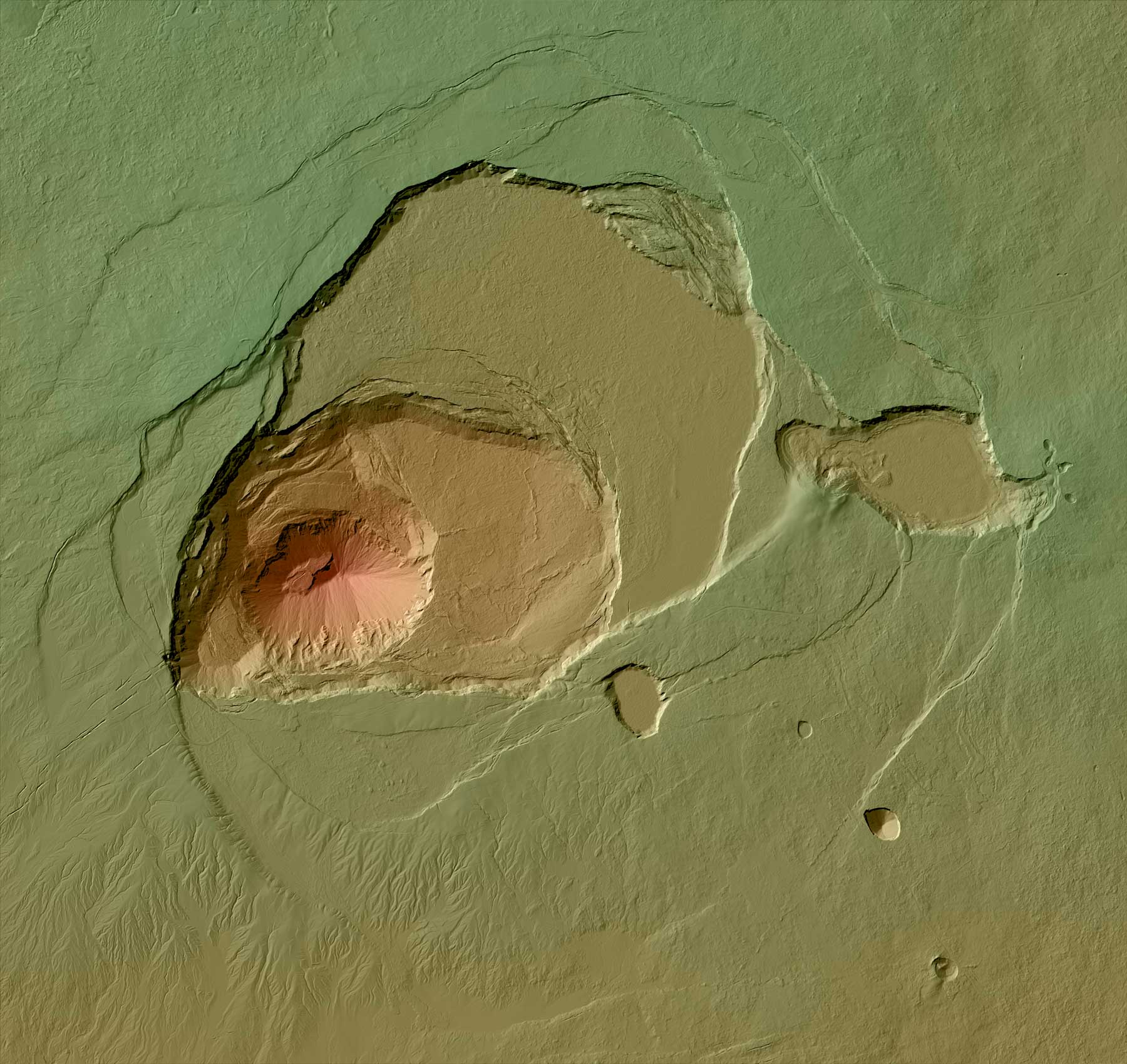
How I produce a custom shaded relief for Kilauea Volcano by combining edge detection raster functions in ArcGIS Pro and image filtering in Adobe Photoshop.
Twelve Stripes of the Globe
Date
December 12, 2020
Views
6,925 Views
Reading Time
9 Mins Read
How to design twelve stripes in ArcGIS Pro, which if printed and stitched together will reproduce a paper Globe! The classic old-school method!
Anaglyph 3D WebMap with the ArcGIS API for JavaScript
Date
December 1, 2020
Views
2,819 Views
Reading Time
7 Mins Read
How I produce a WebMap, which depicts the relief of Japan in Anaglyph 3D, with the ArcGIS API for JavaScript and layers available on ArcGIS Online.
Nautical Compass
Date
November 18, 2020
Views
2,779 Views
Reading Time
4 Mins Read
A multipurpose package of resources for reviving the Nautical Compass on maps.
Shadowplay
Date
November 15, 2020
Views
4,418 Views
Reading Time
15 Mins Read
How I produce a filtered weighted multi-directional shaded relief, with full control of the combined light sources in ArcGISPro and Photoshop.
Your support is welcome!
If you really enjoy my blog and have benefited from the knowledge and experience I share here, you are more than welcome to make a donation or become a Patron, to help keep this content open, free and up-to-date!